 Artwork H 1500x W 1200mm / Image Size H 1189x W 841mm on Fabriano 2000gsm Paper / Unique Giclée Print - Limited Number / Contact me for more info!
 Artwork H 1500x W 1200mm / Image Size H 1189x W 841mm on Fabriano 2000gsm Paper / Unique Giclée Print - Limited Number / Contact me for more info!
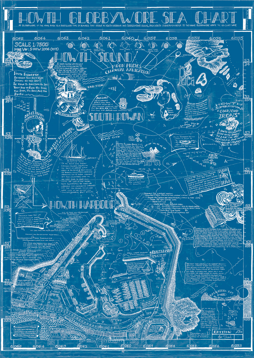
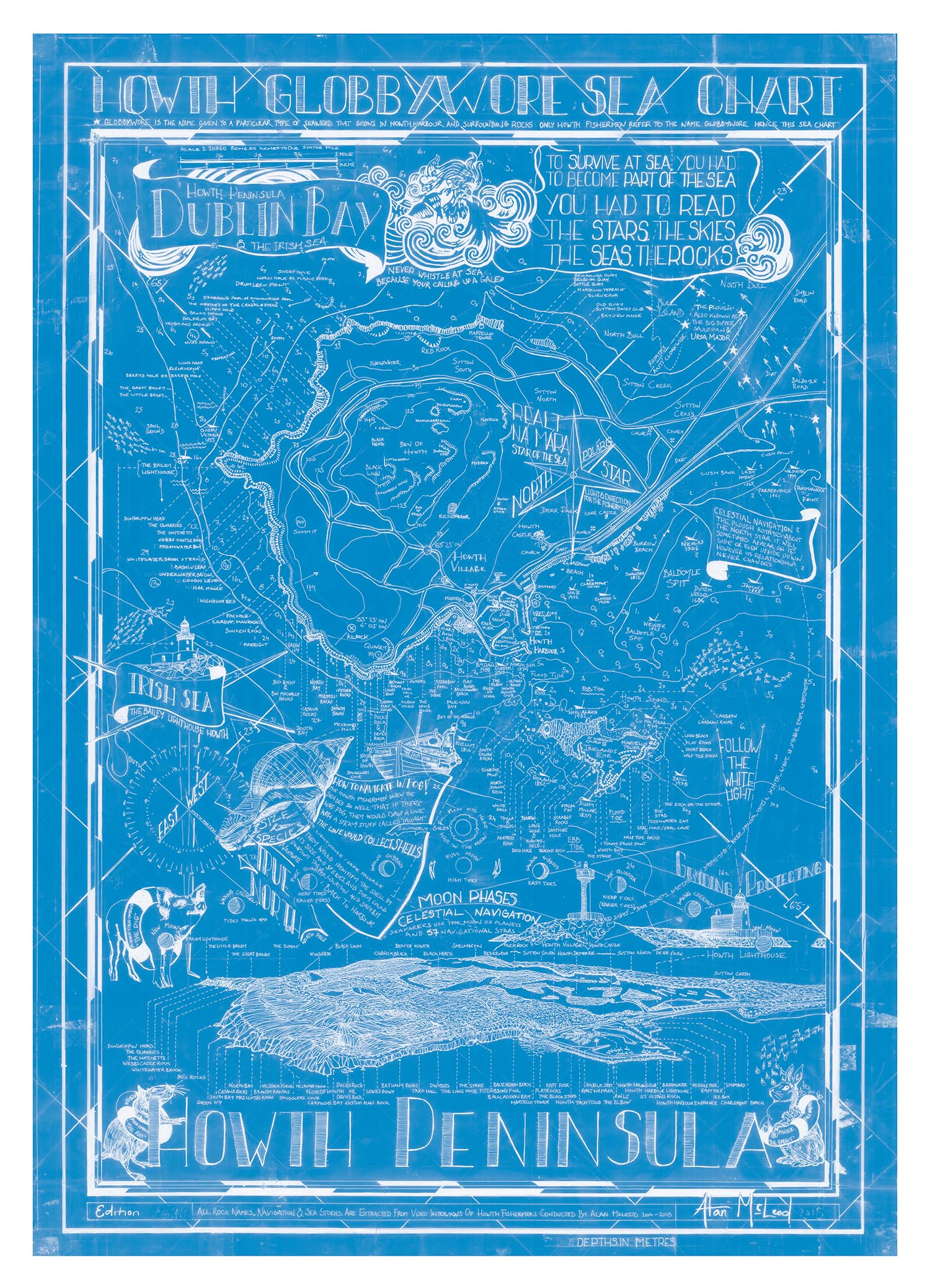
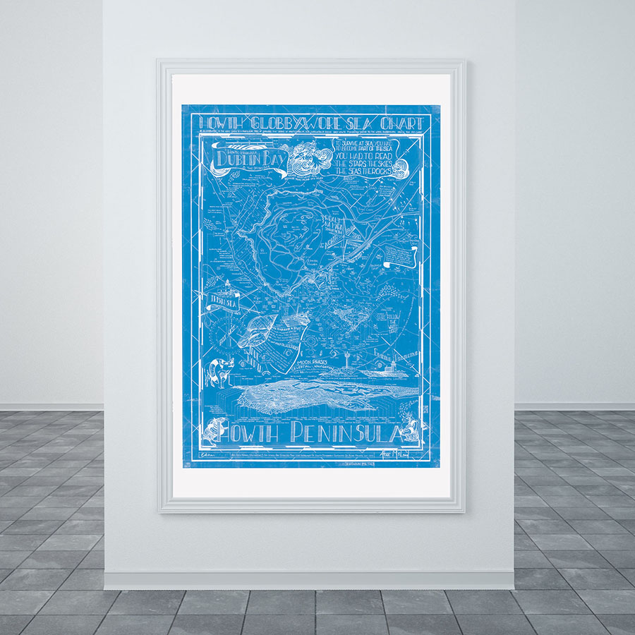
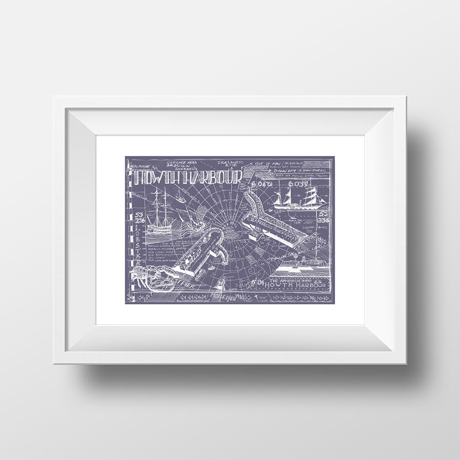
Since setting up his art studio in Howth ten years ago McLeod has befriended the local lobster boat men, this in turn has resulted in their assistance and co-operation in the majority of his art projects. The Howth fisherman are by nature a close-knit and reserved group of men, however, over time as they became familiar with McLeod they shared their considerable knowledge of the heritage and traditions of the sea with him.
McLeod was especially fascinated by how the fishermen visualised the sea and its environment. They created a 3D map of the sea-bed in their heads. They understood the ebb and flow, cold and warm water currents and the many tidal turns of the surrounding sea. They could pin-point the locations of wrecks and knew how to avoid collisions with them. These extraordinary men could also read the stars, skies, seas and rocks. These skills contributed the successful departures, bounties and safe return of the fishermen into Howth harbour.
The fishermen had names for all the rocks around the peninsula. This local knowledge is essential in order to pin-point good fishing grounds, retrieve lost fishing equipment and occasionally save human lives. The rocks names evolved from the names of people, places and things, for instance: Mrs. Llyod's Rocks , Casana Rocks, and Green Ivy. These aural place names, sea visualisations etc were passed on from father to son, neighbour to neighbour and so on. McLeod noted that this unique local mapping system, which was a community construct, was in danger of dying out and that if it was not recorded it could, with the passing of time, be lost forever.
With this in mind McLeod invited the fishermen to participate in documenting the aural sea heritage of the Howth Peninsula. The aim of the Globbywore sea chart was to collate the mens' vernacular knowledge into a number of sea charts, (McLeod is currently working on the Howth Harbour Sea Chart). The final objective was to create an edition of prints and make them available for loan or purchase therefore insuring that the aural heritage of the Howth fishermen was recorded and mapped for generations to come.
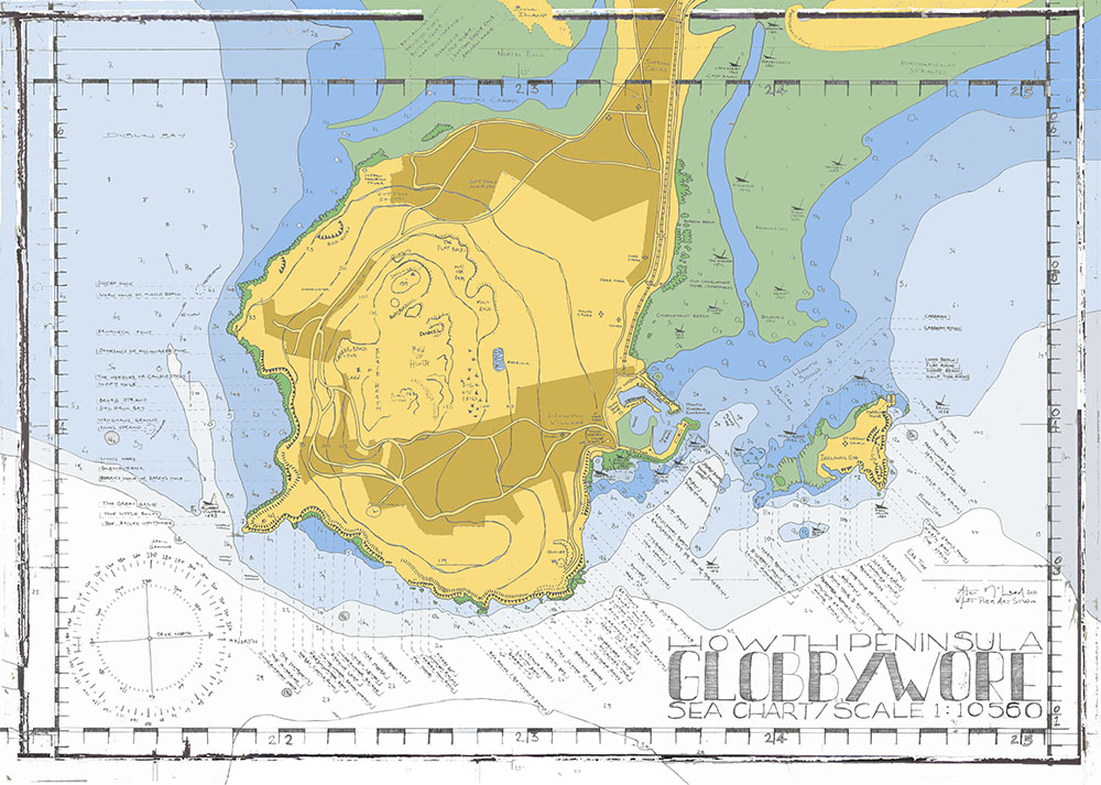 GlobbyWore 2nd Stage Sea Chart - Howth Peninsula
Overal size 1040 x 1400mm / Map size 830 x 1180mm, Pigmented Ink on 200gsm Archival Paper, Edition of 50 only. Supplied unframed. Free Global Delivery included in Price. Please Contact me for Price.
Print size A3, 420 x 297mm. please click on collection for more details.